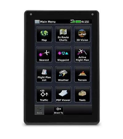
ADVANCED PORTABLE AVIATION NAVIGATION WITH A 7” DISPLAY
Fly confidently with our rugged, reliable, purpose-built GPS that includes our latest in-flight features, including IFR approaches, arrivals and departures, plus our familiar touchscreen interface.
Bright days are no problem — with our vivid, sunlight-readable touchscreen display.
Make IFR flying easier by adding airways and IFR approaches, arrivals, departures and more to your route.
Be aware down low. See obstructions and wires with our WireAware™ wire-strike avoidance technology.
Weather and traffic? Check, and check. Just pair with a GTX™ 345 transponder or GDL® 52 series datalink.
Prep for your flight with wireless Internet weather and automatic data downloads.
Take off with round-trip power. Get up to 4 hours of battery life on each charge.
BRIGHT SCREEN
The large, sunlight-readable 7” touchscreen display is twice as bright as many tablets, with portrait and landscape display options and intuitive pinch to zoom and panning.
DYNAMIC MAPS
Quickly and reliably acquire GPS and GLONASS satellite constellations to display rich, interactive, dynamically drawn and customizable aviation maps.
FLIGHT PLANS
Creating flight plans is easy. Enter a starting waypoint and destination, then insert segments — including airways, as well as IFR departures, arrivals and approaches.
Physical & Performance
- Physical dimensions: 7.29”W x 4.85”H x 0.91”D (18.5 x 12.3x 2.3 cm)
- Display size: 7″ diag (17.8 cm)
- Display resolution, WxH: 480 x 800; portrait and landscape orientation
- Display type: touchscreen WVGA color TFT with white backlight
- Weight: 19.8 oz (561 g)
- Battery: Rechargeable lithium-ion
- Battery life: Up to 4 hours during most daytime conditions, (80% backlight)
- SBAS/WAAS/GLONASS receiver: high-sensitivity with WAAS position accuracy
- Voltage range: 10-35
- Route Data: VFR/IFR
- USB connection: yes (USB-C)
- Expandable memory: yes (microSD™ cards)
This device is not approved for primary IFR navigation.


